( TOTAL MILAGE TO DATE 6416)
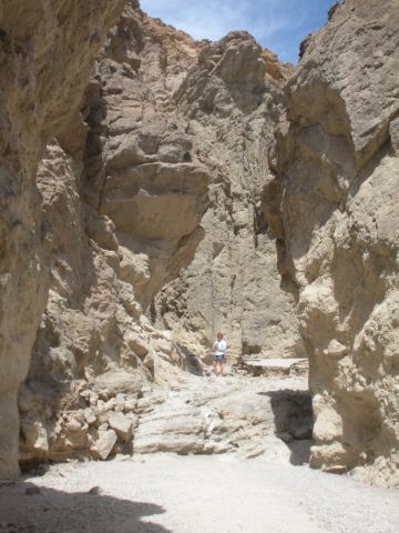
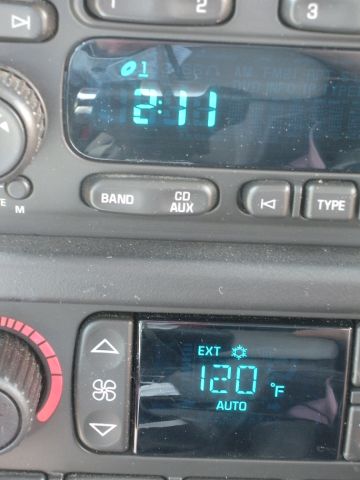
We left Lone Pine after finding out that a lot of early westerns, TV & movies, were filmed in the area – lots of pictures on the dining room wall. It was another beautiful day as we headed south and then west to Death Valley. We crossed a first range of mountains and went down into the Panamint valley which seemed like a Death Valley to me but is actually a little higher. Then back up over Towne Pass at 4956 Ft. and down into the “Hottest, Driest, Lowest” place in the US. We went through “Panamint Springs”, “Stovepipe Wells” and out to “Furnace Creek”(Elevation 190 ft Below Sea Level). It was HOT & got up to 122 degrees at one point. We had lunch in Furnace Creek and took a short hike up “Golden Canyon” but it really wasn’t very good weather for a lot of hiking. The terrain was more varied in color and texture than anything we have seen. The Timbisha Shoshone Indians still live in the area – but I’m not sure why.
We drove out of Death Valley and went south through the Panamint valley to Ridgecrest, CA near the China Lake Naval Weapons Center where they tested some of the stuff I did at one point in my old career. Tomorrow Palm Springs and then on to Bg Bear to Dave & Lucy our good friends from San Diego days.

Sierra Nevada Mountains

Mt. Whitney is tallest point in center

Our Hotel in Pine Valley


View of Panamint Valley


View into Death Valley!


Sand Dunes


Jen ??


Actually got up to 122 Degrees


Back over the pass out of Death Valley

Leave a comment