Posted by: pt2usa | September 29, 2009

DAYS 42-44 – Headed Home!

( TOTAL MILAGE – 10,062)

 On Friday morning we headed for Dayton, Ohio to see very close friends, Bob & Carol Bedore.  We had a wonderful time talking and laughing & Patti took them for close to $1.20 when we played cards that night.   On Saturday we went to our old home town of Wintersville, Ohio.   Had a great visit with Patti’s brother Bob & his wife Sandi – and even had ribs at the best rib place in the world – DeeJay’s.  Sunday we headed for home.

 We are so thankful to have had the chance for this wonderful experience.  Special thanks to our Daughters, son-in-laws & grandchildren for taking care of everything while we were gone – couldn’t have done it without you!

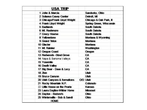
 Below is our final list of stops – close, but not exactly as planned.

USA_LIST_FINAL

A quick shot at the Arch as we head through St. Louis.

A quick shot at the Arch as we head through St. Louis.Tom's boyhood home - Terra Haute, IN - What no Plaque??


Back to the Buckey State

Back to the Buckey State

The Ribs are the BEST

The Ribs are the BEST

Mass at Blessed Sacrement in Wintersville - I remember my dad makingtheis cross when I was about 5 years old.

Mass at Blessed Sacrement in Wintersville - I remember my dad making this cross when I was about 5 years old.

Home again - where is that California sunshine?

Home again - where is that California sunshine?

Posted by: pt2usa | September 25, 2009

DAYS 40/41 Independence, KA & Mansfield, Mo 9/24-24/09

( TOTAL MILAGE TO DATE – 9213)

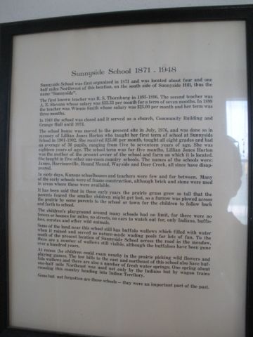
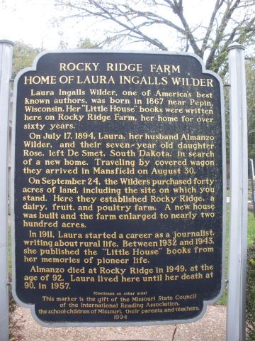
 We spent Wednesday & Thursday traveling through Kansas and Missouri and visiting 2 sites where Laure Engalls Wilder, the author of the “Little House on the Prairie” series lived.   The first location, Independence Kansas, was the original site of the Little House and, though the original is gone, a replica has been constructed.   As you will see the house was not quite up to our current standards!  The second site was “Rocky Ridge Farm” in Mansfield, Missouri where Laura lived after her marriage to Almonzo Wilder.  This is where she did her writing – starting at age 65.

It was very interesting to see these places and realize how different and sometimes harsh life was then.  Laura & her family were strong and principled people.  

 Tomorrow we head into Ohio for visits with friends and family and then head back to Endicott – I can’t believe six weeks has gone by and we soon will be back home.

 DSCN1927

DSCN1901

DSCN1903

DSCN1904

DSCN1912

DSCN1908

DSCN1909

*** “Pa”  dug this well!

DSCN1913

DSCN1923

DSCN1921

DSCN1922

DSCN1928

DSCN1929

DSCN1942

DSCN1943

DSCN1932

DSCN1933

DSCN1937

DSCN1940

DSCN1939

DSCN1944

Posted by: pt2usa | September 23, 2009

DAY 39 Eastern Colorado & Western Kansas – 9/22/09

( TOTAL MILAGE TO DATE – 8590)

 Tomorrow we head for “The Little House on the Prairie”   


*********Repeat this picture for 425 miles

DSCN1897

Posted by: pt2usa | September 23, 2009

DAY 38 Estes Park – 9/21/09

( TOTAL MILAGE TO DATE – 8154)

 We woke up to a surprise thunder filled snowstorm but only got a couple of inches.  After breakfast we headed over to the Stanley for our Ghost Tour.  After spending time in Estes Park we went down into Denver to spend the night.

Early winter in the Rockies

Early winter in the Rockies

 DSCN1833

Elk right outside the hotel

Elk right outside the hotel

The boss of this harem

The boss of this harem

Into the music room for the tour start

Into the music room for the tour start

Patti with Flora Stanley's piano

Patti with Flora Stanley's piano

Up to teh haunted second floor

Up to the haunted second floor

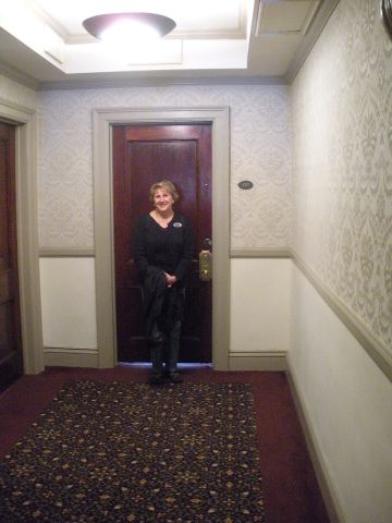
Stephen King's room - 217

Stephen King's room - 217

Room 217

Room 217

Haunted Staircase - The Vortex

Haunted Staircase - The Vortex

The twin girls didn't show up on teh picture

The twin girls didn't show up on teh picture

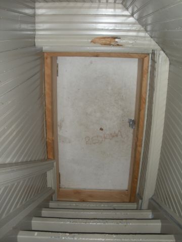
Attic door - who would write "redrum" here?

Attic door - who would write "redrum" here?

Keven - he had all the scoop

Keven - he had all the scoop -- and 401 is haunted too.


The childrens play area - now they run through the halls at night.

The childrens play area - now they run through the halls at night.

Childrens desk

Children's desk

100 year old elevator - we took the stairs.

100 year old elevator - we took the stairs.

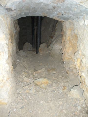
The haunted basement & tunnels

The haunted basement & tunnels

DSCN1880

Stanley Steamer

Stanley Steamer

Lobby - these are real people not ghosts

Lobby - these are real people not ghosts

Safe Outside

Safe Outside

DSCN1890

Posted by: pt2usa | September 23, 2009

DAY 37 Rocky Mountain National Park – 9/20/09

( TOTAL MILAGE TO DATE – 7852)

 Sunday we drove east on I 70 from Grand Junction, CO into Rocky Mountain National Park.  The weather was cold, windy and rainy and there was a lot of traffic headed to Denver.  Once we  headed north on route 40 into the mountains the rain let up and we had some pretty clouds to drive through as we took the “Trail Ridge Road” east over the mountains and down into Estes Park.  We saw quite a few elk but the real excitement was the drive. 

 Trail Ridge Road It is the “highest continuous paved road” in the United States and reaches 12,183ft.  Up near the top it also does not have guard rails.  As we headed into some of the switchbacks it seemed that we were going to drive off into the clouds.  The mountains are massive.  We made it  over the top and down into Estes Park but my palms were a little sweaty and Patti covered her window with a pillow to avoid looking over the side.  We checked into the Best Western Silver Saddle and then went to a late dinner at the Stanley Hotel.

 Tomorrow we do the “Ghost Tour” at the Stanley.  


*****Heading into the mountains*****

 DSCN1802

DSCN1804

DSCN1806

DSCN1807

DSCN1808

DSCN1810

DSCN1813

DSCN1814

Slip to the right is a long way down!

Slip to the right is a long way down!

DSCN1819

DSCN1823

DSCN1824

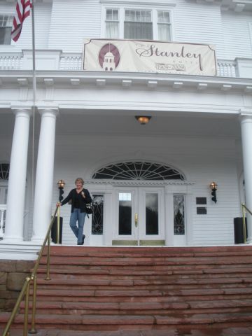
Nightime at the Stanley Hotel

Nightime at the Stanley Hotel

Posted by: pt2usa | September 22, 2009

DAY 36 Bryce Canyon National Park – 9/19/09

( TOTAL MILAGE TO DATE – 7529)

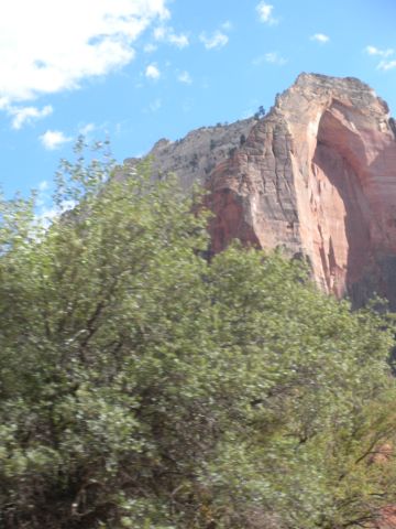
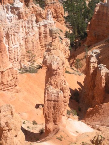
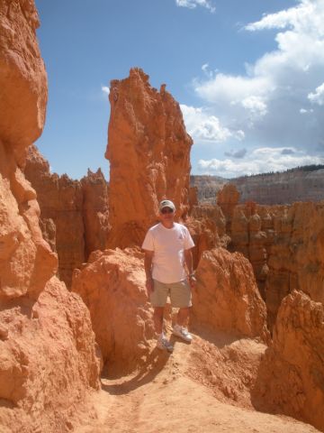
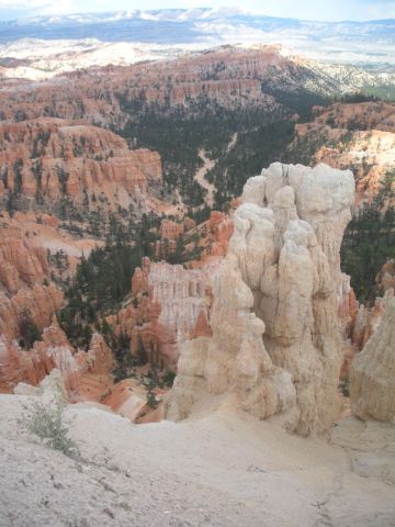
 Saturday we drove east out through Zion and northeast to Bryce Canyon.  The exit through Zion gave us some views of different layered limestone.  Bryce Canyon was another whole new landscape  – like a giant, multicolored set of sand drip sculptures.   We enjoyed it a lot.  We are really overwhelmed with the beauty and diversity of all that we are seeing. 

 After Bryce we drove on to Grand Junction Colorado – further than we wanted because the Green River, Utah Melon Festival tied up all the hotel rooms.  The drive on I-70 through Utah was educational.  Most of what we drove through was more incredible rock formations – not much of anything else.  Every thirty miles or so there would be an exit with the name “Ranch Exit – No Services” – not sure what the ranch was.  Hope the pictures tell the story a lot better than I can.

 On Sunday we head to the Rocky Mountains.

*******OUT THROUGH ZION******

DSCN1697

DSCN1702

DSCN1704

DSCN1710

DSCN1711

DSCN1713

DSCN1717

DSCN1721

DSCN1722

DSCN1725

DSCN1726

DSCN1728

DSCN1733

DSCN1734

DSCN1737

DSCN1744

DSCN1748

DSCN1752

DSCN1753

DSCN1754

DSCN1756

DSCN1760

DSCN1765

DSCN1766

DSCN1769

DSCN1772

DSCN1775

*****I 70 Through UTAH*******

DSCN1777

DSCN1779

DSCN1783

DSCN1785

DSCN1788

DSCN1793

DSCN1796

DSCN1797

Posted by: pt2usa | September 19, 2009

DAY 34-35 – Zion – 9/17-18/09

( TOTAL MILAGE TO DATE – 7094)

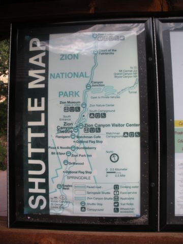
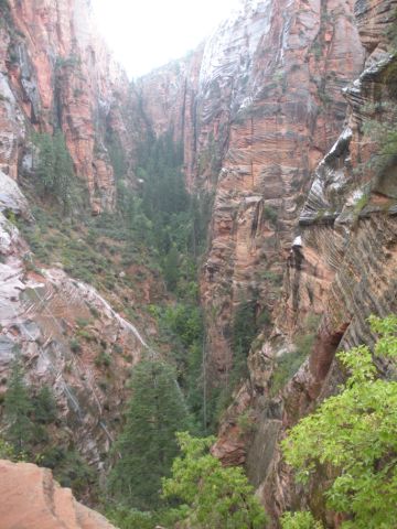
 On Thursday morning we left Las Vegas headed for Zion National Park.  As we got closer the terrain changed dramatically with more color and sandstone formations.   We checked into the Best Western Zion Park Inn, rested up a bit and then took the shuttle bus 3 miles to the park.  The park service runs a shuttle through Zion which gave us a great overview of things in the main canyon. We went to the museum and saw a good movie on the formation of the canyon and information on the people who have settled here from early Indians to the later Mormons. 

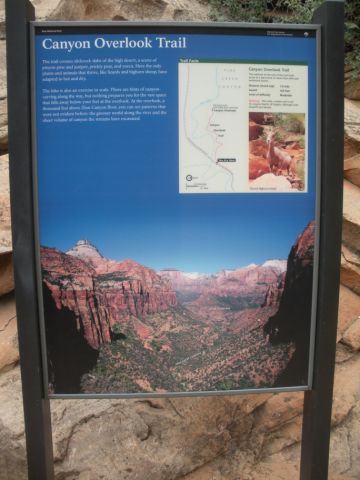
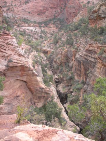
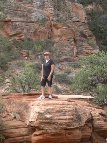
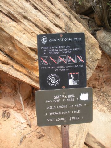
On  Friday we drove a scenic route into the eastern part of the park and then did the “Canyon View” hike.   After lunch we decided to take on the “Angel’s Landing” hike – a real tough one with about 1500 ft rise over 2.5 miles. I didn’t even have to trick Patti into doing it!   Here’s the books description  

   “Hazards: Sheer cliffs at high elevations while hiking on a narrow fin. Not suggested for children or those with a fear of heights. Avoid standing near the edge at all times! Do not hike the trail when it is wet, storming, or when high winds are present.”

 We made it up the  sheer cliff part and were moving along the guide chains when a thunder storm moved in.  We had to turn around and head back down because of the lightning, winds and slippery conditions.  It was disappointing not to reach the top but a great hike anyway.  Patti did great and was ahead of me on the ridge when we had to turn around.   We heard later on the news that two hikers, not on Angel’s Landing, were struck by lightning.

 Tomorrow we are going to visit Bryce Canyon and then ???


Entering Zion

Entering Zion


DSCN1563

DSCN1594

DSCN1565

DSCN1570

DSCN1577

DSCN1582

DSCN1584

DSCN1588

DSCN1597

View from hotel

View from hotel


Startin our "Canyon View" hike

Starting our "Canyon View" hike

DSCN1612

DSCN1616

DSCN1619

DSCN1627

DSCN1628

DSCN1634

35 days of togetherness and still speaking - most of the time!
35 days of togetherness and still speaking - most of the time!

Starting on the trail to Angel's Landing
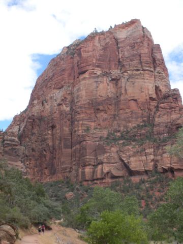
Starting on the trail to Angel's Landing

Our goal is the top of this thing

Our goal is the top of this thing

View back

View back

Up a little higher

Up a little higher

DSCN1654

Resting in a sandstone pocket

Resting in a sandstone pocket

A BIG Black Widow sharing the trail! - We wer mor carefull about sitting on the rocks after this.

A BIG Black Widow sharing the trail! - We were more carefull about sitting on the rocks after this.
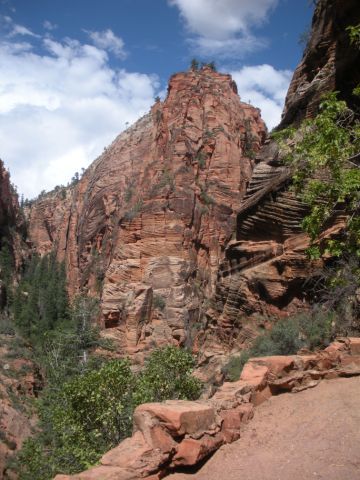
Interesting rocks everywhere

Interesting rocks everywhere

At "Scout Lookout" - ready for the tough part.

At "Scout Lookout" - ready for the tough part.

Ready for the challenge!

Ready for the challenge!

View over the side.
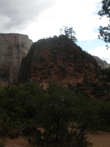
View over the side.

View of the final trip up!

View of the final trip up!

Headed back down in the rain.
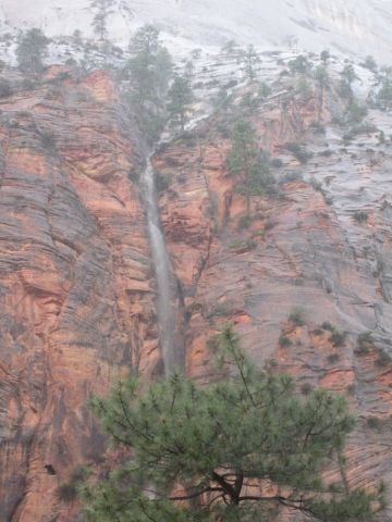
Headed back down in the rain.

The rain caused waterfalls to spring up many places along the cliffs.
The rain caused waterfalls to spring up many places along the cliffs.

DSCN1672

DSCN1675

Final view of Angel's Landing

Final view of Angel's Landing

( TOTAL MILAGE TO DATE ~6900)


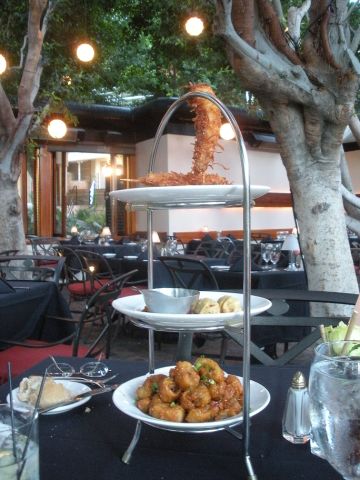
We left Ridgecrest on Monday morning and went to spend a relaxing day in Palm Springs.  We had dinner at Spencer’s Restaurant, a place we went to with Jean & Ann  about 20 years ago.  It brought back a lot of memories and the food was really exceptional – best fish I’ve ever had!  Palm Springs is beautiful.  The next morning I did some CASA reports and Patti went shopping in downtown Palm Springs.  

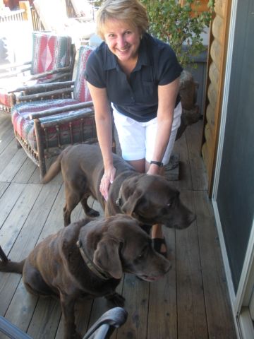
 After a late lunch we drove about 2 hours back to Big Bear Lake and met our San Diego friends, Dave & Lucy Hokanson, their daughter, Alexa, and new grandson, Juan Carlo.  We had dinner together and stayed with them until after lunch on Wednesday.   Is was great to see them and catch up on all that’s happened lately.  We also got to meet  2 other family members, Remington and  Winchester, Chocolate Labs.

  On Wednesday we drove to Las Vegas to spend the night on our way to Zion National Park in Utah.                                            ******* WE ARE HEADED EAST!!!        BACK TO NY – EVENTUALLY. *******

Patti found a friend at Starbucks off I-10

Patti found a friend at Starbucks off I-10

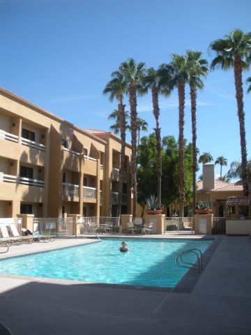
This is the first place we headed at the hotel in Palm Springs

This is the first place we headed at the hotel in Palm Springs

DSCN1520

Spencer's old dining room built into the mountainside

Spencer's old dining room built into the mountainside

In Spencer's new dining room

In Spencer's new dining room

DSCN1525

DSCN1528

DSCN1530

DSCN1534

Morning mass at Our Lady of Solitude

Morning mass at Our Lady of Solitude

Lunch in Palm Springs - How about that name!

Lunch in Palm Springs - How about that name!

Patti w/Sonny Bono

Patti w/Sonny Bono

Dinner w/Dave & Lucy

Dinner w/Dave & Lucy

Juan Carlo

Juan Carlo!

PAtti w/Remington & Winchester

Patti w/Remington & Winchester

Posted by: pt2usa | September 14, 2009

DAY 30 – Death Valley – 9/13/09

( TOTAL MILAGE TO DATE 6416)

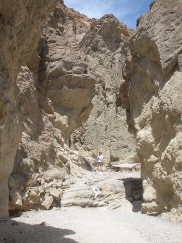
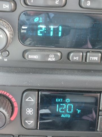
 We left Lone Pine after finding out that a lot of early westerns, TV & movies, were filmed in the area – lots of pictures on the dining room wall.  It was another beautiful day as we headed south and then west to Death Valley.  We crossed a first range of mountains and went down into the Panamint  valley which seemed like a Death Valley to me but is actually a little higher.  Then back up over Towne Pass at 4956 Ft. and down into the “Hottest, Driest, Lowest” place in the US.  We went through “Panamint Springs”, “Stovepipe Wells” and out to “Furnace Creek”(Elevation 190 ft Below Sea Level).   It was HOT & got up to 122 degrees at one point.  We had lunch in Furnace Creek and took a short hike up “Golden Canyon” but it really wasn’t very good weather for a lot of hiking.    The terrain was more varied in color and texture than anything we have seen.  The Timbisha Shoshone Indians still live in the area – but I’m not sure why. 

 We drove out of Death Valley and went south through the Panamint valley to Ridgecrest, CA near the China Lake Naval Weapons Center where they tested some of the stuff I did at one point in my old career.   Tomorrow Palm Springs and then on to Bg Bear to Dave & Lucy our good friends from San Diego days.


Sierra Nevada Mountains

Sierra Nevada Mountains

Mt. Whitney is tallest point in center

Mt. Whitney is tallest point in center

Our Hotel in Pine Valley

Our Hotel in Pine Valley

DSCN1426

View of Panamint Valley

View of Panamint Valley

DSCN1433

View into Death Valley

View into Death Valley!

DSCN1442

DSCN1444

DSCN1489

Sand Dunes

Sand Dunes

DSCN1451

DSCN1453

Jen ??

Jen ??

DSCN1456

DSCN1457

DSCN1461

DSCN1464

DSCN1468

DSCN1471

DSCN1488

DSCN1489

DSCN1493

Actually got up to 122 Degrees

Actually got up to 122 Degrees

DSCN1508

DSCN1506

Back over the pass out of Death Valley

Back over the pass out of Death Valley


DSCN1511

( TOTAL MILAGE TO DATE 6149) —– (TOTAL PICTURES TO DATE ABOUT 1150)

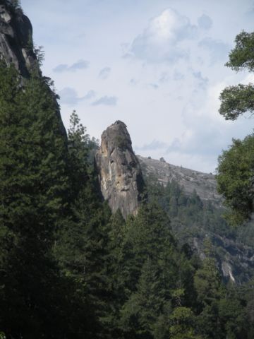
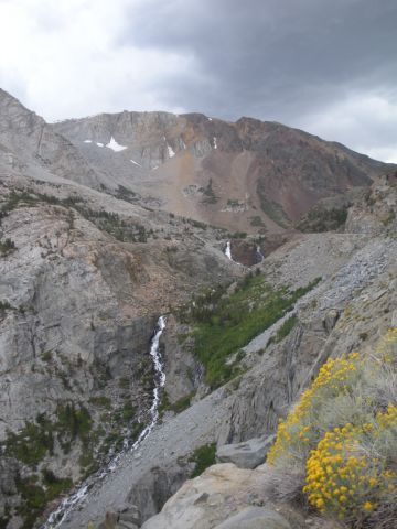
 We left Oakhurst after our day of rest and headed back into Yosemite.   This time we did a short loop through the valley and then connected to “Tioga Road” which crosses Yosemite from west to east finishing up at the east entrance to the park which is at Tioga Pass – elevation 9945 feet.  The views were different than the valley which has high cliffs on both sides.  As the pictures show the Tioga Highway has a lot of different rock formations and several lakes.

 Next we headed down on the east side of the Sierra Nevada mountains into the Inyo National Forest and then went south to Lone Pine, California.  We passed a little town called “Tom’s Place.”  There was a rain storm over the mountains to our west and we had some great views.  Lone Pine is like a frontier town directly east of Mt. Whitney which at 14,505 feet is the HIGHEST in the contiguous US.   Lone Pine is also about 50 miles from the LOWEST point is the US in death valley – 282 feet below sea level!  We went to mass at Santa Rosa church, had a steak dinner at the Totem Café and headed off to blog.

 Tomorrow it’s into Death Valley.   Hopefully there will be more blog entries later.

 DSCN1398

Back into Yosemite

Back into Yosemite


DSCN1390

DSCN1339

DSCN1340

DSCN1344

DSCN1348

DSCN1350

DSCN1352

DSCN1353

DSCN1354

DSCN1355

DSCN1358

DSCN1364

DSCN1365

Not t obe outdone by my conquest of El Capitan,  Pattie decided on  technical climb without the aid of the appropriate gear!

Not to be outdone by my conquest of El Capitan, Patti decided on technical climb without the aid of the appropriate gear!

 DSCN1371

DSCN1372

DSCN1374

DSCN1379

DSCN1382

DSCN1384

Headed down to Loan Pine

Headed down to Loan Pine


DSCN1400

Mt. Whitney from Loan Pine at sunset

                                     Sierra Nevada mountains from Loan Pine at sunset


Older Posts »

Categories